- About Us
- Government
- Tribal Services
- Tribal Enterprises
- Tourism & Hospitality
- Health App
- Internet
- Careers.
- About Us
- Government
- Tribal Services
- Tribal Enterprises
- Tourism & Hospitality
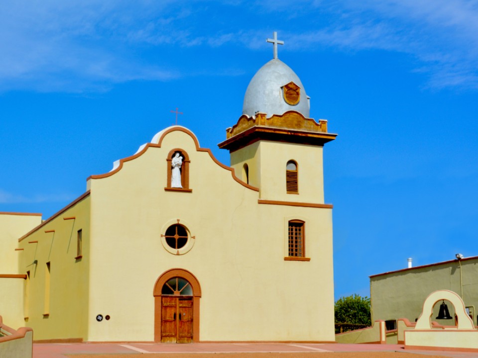
Ysleta del Sur Pueblo (YDSP, "the Pueblo," "the Tiguas") is one of three federally recognized Native American tribes and the only Pueblo in the State of Texas. The current YDSP population is approximately 4,226 members nationwide. Thirteen miles from downtown El Paso, Ysleta, Texas, has been home to the Tigua people for over 300 years.
During the period of early Spanish settlement (1598–1680), relations between the Pueblo Indians and the Spaniards were strained, which brought fierce oppression of all Pueblo people. In 1680, New Mexico Pueblo Indians rebelled against the Spaniards, causing many tribal factions to relocate to modern-day northern New Mexico and West Texas, which includes the El Paso/Tigua region. The Tigua people of Ysleta del Sur were industrious farmers who raised wheat, corn, cattle, and horses. The Tigua were also instrumental in building the Ysleta Mission. YDSP is the oldest community in Texas and the oldest-running government since its establishment in 1682. The Pueblo's culture continues to flourish as each generation proudly promulgates its heritage.
The Pueblo is an active partner in the greater El Paso region. Its government and business contributions support the Pueblo and the greater El Paso economy. The Pueblo owns and operates a tribal government and diverse enterprises providing meaningful employment and benefits for tribal members and regional citizens. The Pueblo is proud to be an employer of choice in the region with a local workforce nearing 1,200 across all tribal entities -- YDSP members fill 30% of these positions. Furthermore, gainful employment opportunities are critical to the Pueblo achieving economic self-sufficiency while improving its overall quality of life.
The revenue generated from these tribal sectors funds essential community infrastructure and services, such as health care, education, law enforcement, tribal courts, elder assistance, housing, economic development, and capital improvements. Education, job creation, and workforce skill building are YDSP priority areas. YDSP's economic development efforts create avenues for self-determination and self-governance.
YDSP embodies the principles of self-governance throughout all of its facets. Self-governance gives tribal governments autonomy and decision-making authority over the federal financial resources provided for the benefit of the Indian people while setting economic foundations that leverage their unique sovereign statuses. Tribes perform better when they set their own trajectories, allocate their own resources, and establish priorities based on their needs. It is also a tool to broaden self-determined efforts that spark innovation, courage, and resiliency. Self-governance is not a program with a beginning and end; it is a paradigm shift that changes the status quo thinking to that of endless potential.
The Pueblo also incorporates self-governance tenets through its partnerships and business engagements, with expectations of dealing in a government-to-government manner. From its government operations to enterprise development to service delivery, the Pueblo implements self-governance strategies to design programs that address YDSP priority areas.
Thank you for visiting the YDSP website and learning about Tigua history, community, and services/products. Please explore the calendar of events and plan a visit to the Pueblo, especially during cultural and other community events.